Cyclone Akvan landfall day: IMD says it has weakened to a cyclonic storm and will cross close to Gopalpur this forenoon
IMD's 5:30 am bulletin (No. 36) gives landfall winds of 70-80 km/h gusting to 90, down from 90-100 km/h a day earlier, and keeps the Red Message for the north Andhra Pradesh and south Odisha coasts. No casualty figure has been officially reported.
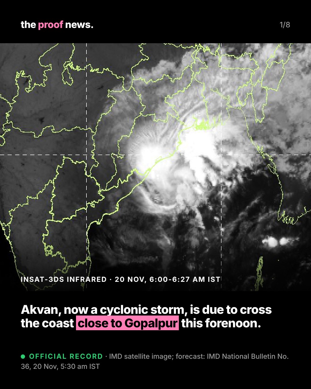
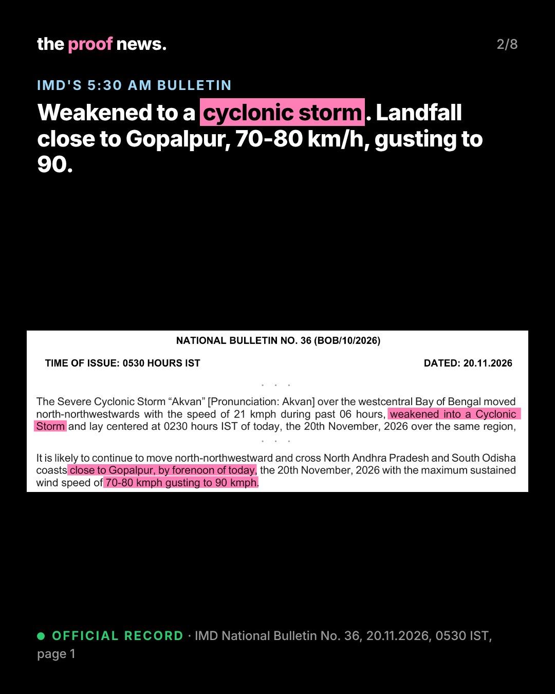
Official recordIMD National Bulletin No. 36 (BOB/10/2026), issued at 0530 IST on 20 November 2026: the Severe Cyclonic Storm Akvan moved north-northwest at 21 km/h over the previous six hours, "weakened into a Cyclonic Storm" and lay at 0230 IST near 17.7°N, 84.9°E over the westcentral Bay of Bengal, about 110 km southeast of Kalingapatnam, 170 km east of Visakhapatnam (Andhra Pradesh), 170 km south of Gopalpur and 250 km south-southwest of Puri (Odisha), and 370 km east-northeast of Narsapur (Andhra Pradesh).
Official recordIMD's forecast: it "is likely to continue to move north-northwestward and cross North Andhra Pradesh and South Odisha coasts close to Gopalpur, by forenoon of today, the 20th November, 2026 with the maximum sustained wind speed of 70-80 kmph gusting to 90 kmph" (Bulletin No. 36, page 1). The bulletin keeps the Red Message: cyclone warning for the north Andhra Pradesh & Yanam and south Odisha coasts. IMD says satellite imagery shows land interaction has begun and the storm is being tracked by the Doppler weather radars at Visakhapatnam and Gopalpur.
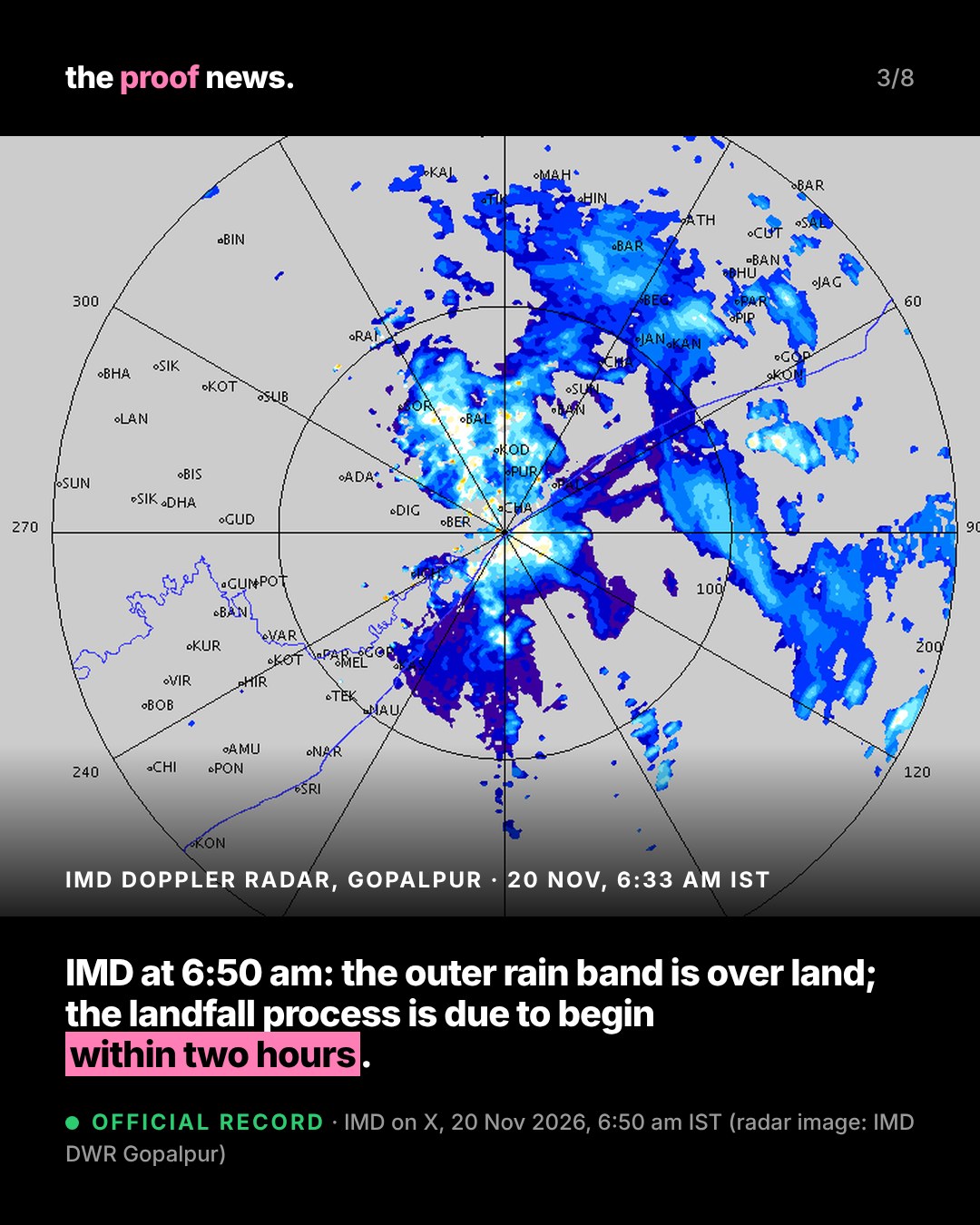
Official recordAt 6:50 am IST IMD said on X that the outer rain cloud band had entered land and "Landfall process will commence during next 2 hours", putting the storm 80 km east of Kalingapatnam and 130 km south of Gopalpur, with landfall "Around forenoon of 20th November, 2026". The post did not give the observation time of that position.
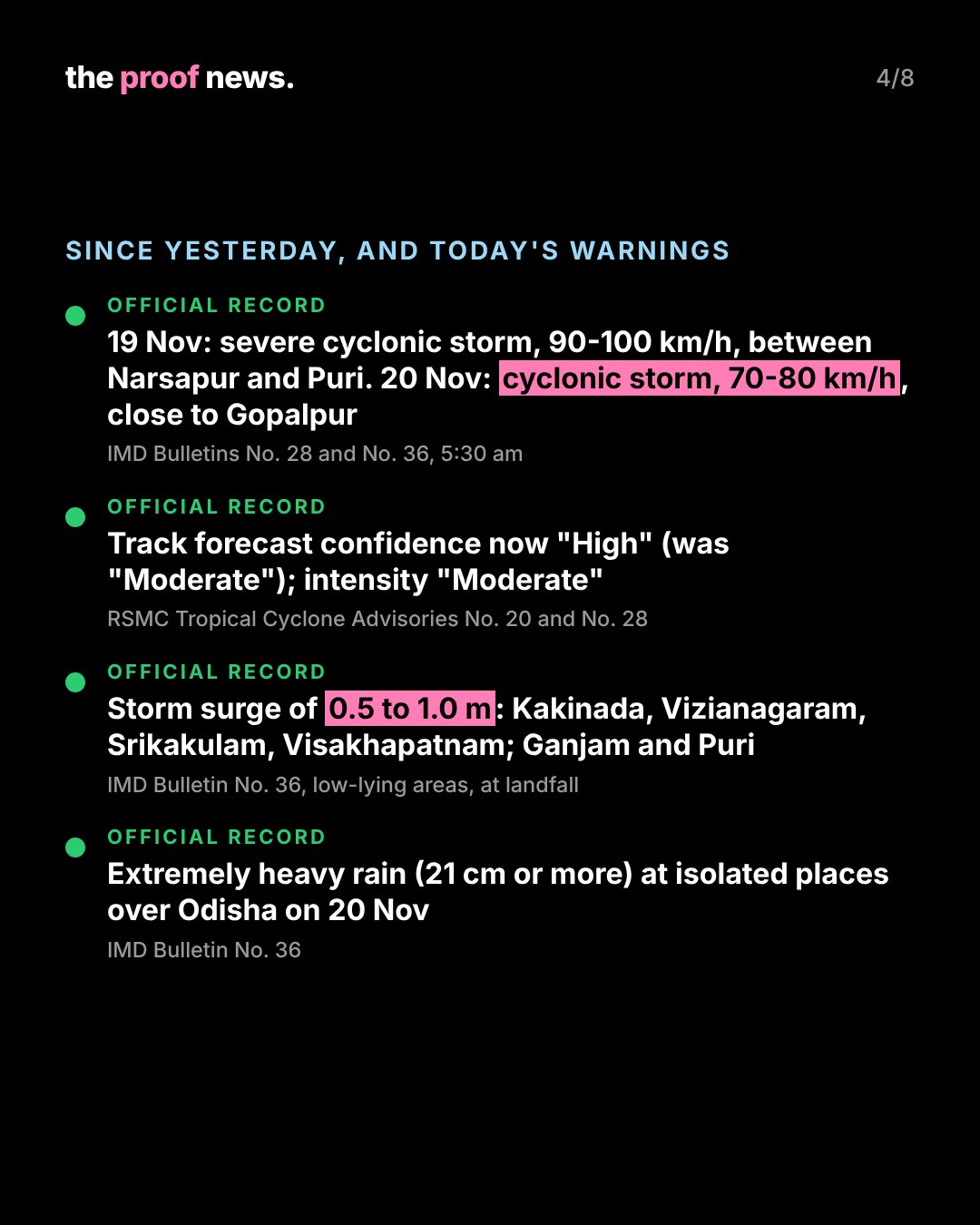
Official recordWhat changed since our 19 November report: IMD's Bulletin No. 28 (5:30 am, 19 November) forecast landfall between Narsapur and Puri by noon on 20 November as a severe cyclonic storm with winds of 90-100 km/h gusting to 110. RSMC New Delhi's Tropical Cyclone Advisory No. 28 (issued 2300 UTC, 19 November) now rates confidence in the forecast track "High" (Advisory No. 20 had "Moderate") and in the forecast intensity "Moderate". It says most models, including IMD's multi-model ensemble, show the storm crossing around 0600 UTC (11:30 am IST), "between Narsapur and Puri, close to Gopalpur", and that wind shear, land interaction and dry air are expected to cause "slight weakening before landfall" and rapid weakening after it.
Official recordWarnings in Bulletin No. 36: storm surge of 0.5 to 1.0 m above the astronomical tide is very likely to inundate low-lying areas of Kakinada, Vizianagaram, Srikakulam and Visakhapatnam districts (Andhra Pradesh) and Ganjam and Puri districts (Odisha) at landfall; the 19 November bulletin had also listed West Godavari and Konaseema. Extremely heavy rain (21 cm or more) is likely at isolated places over Odisha on 20 November, with heavy to very heavy rain at isolated places in Gangetic West Bengal and south Jharkhand. Gale winds of 80-90 km/h gusting to 100 are forecast along and off the north Andhra Pradesh & Yanam coasts till the forenoon, and 70-80 km/h gusting to 90 along the south Odisha coast till the afternoon. Expected impact includes "Major Damage to thatched houses/huts/ kutcha houses"; IMD advises moving coastal hutment dwellers to safer places. Fishermen are advised not to go into the westcentral and northwest Bay of Bengal till the morning of 21 November.
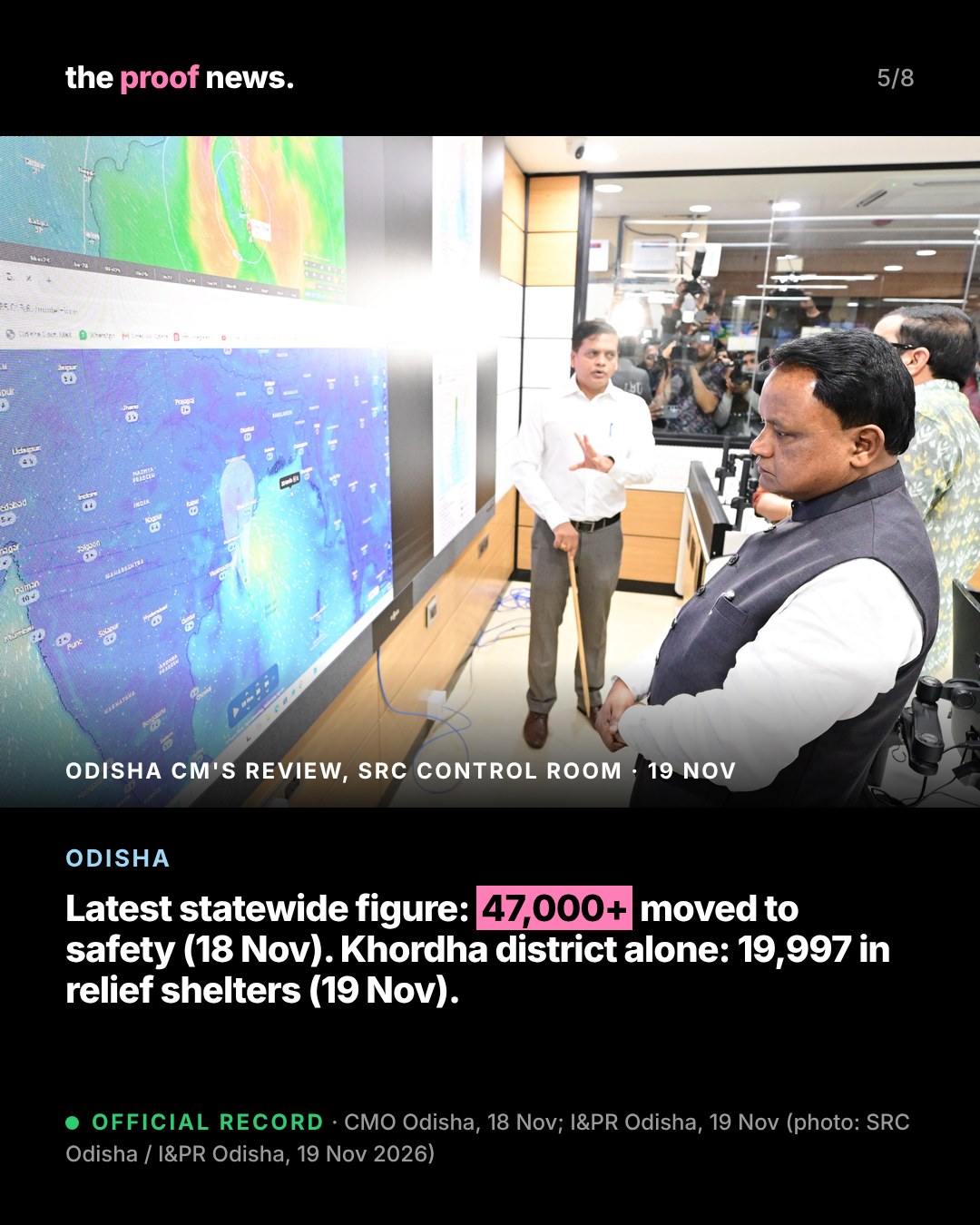
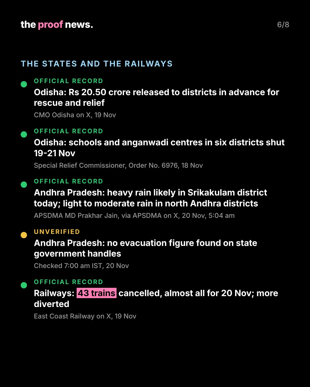
Official recordOdisha (BJP government): the latest statewide evacuation figure we found on official handles is from the Chief Minister's Office on 18 November (10:52 pm IST): more than 47,000 people and 1,313 pregnant women moved to safe places, 448 cyclone shelters operational and 74 rescue teams deployed. On 19 November the state information department said the Khordha district administration had evacuated 19,997 people to relief shelters, including 95 expectant women due to deliver within 15 days, and was running 350 free kitchens. The CMO said on 19 November that an advance fund of Rs 20.50 crore had been provided to districts for rescue and relief. Chief Minister Mohan Charan Majhi reviewed preparations again at the Special Relief Commissioner's control room on the night of 19 November.
Official recordAlso in Odisha: schools and anganwadi centres in Ganjam, Gajapati, Puri, Jagatsinghpur, Kendrapada and Kandhamal are closed from 19 to 21 November (SRC Office Order No. 6976). The Konark Sun Temple and the archaeological museum at Konark are closed from 19 to 21 November by order of the Archaeological Survey of India, Puri. The SRC said the Department of Telecommunications has enabled intra-circle roaming in Ganjam, Gajapati, Puri, Kendrapada, Jagatsinghpur and Khordha so phones can use any operator's network during the cyclone.
Official recordAndhra Pradesh (TDP-led NDA government): the State Disaster Management Authority said at 5:04 am on 20 November that the landfall process had begun and the storm's outer ring had reached the north Andhra and south Odisha coasts. Its managing director, Prakhar Jain, said heavy rain is likely in Srikakulam district today and light to moderate rain in north Andhra districts, and asked people in Srikakulam district to stay alert.
UnverifiedWe found no evacuation figure for Akvan on the Andhra Pradesh government's official handles as of 7:00 am IST on 20 November. We will add it when it is published.
Official recordRailways: on 19 November East Coast Railway posted lists of 43 trains cancelled "in view of Cyclonic Storm Akvan", 39 of them for journeys on 20 November (including the Howrah-Puri, Tatanagar-Brahmapur and Bhubaneswar-Visakhapatnam Vande Bharat services in both directions), and diverted others, including the Visakhapatnam-Amritsar Hirakud Express (20807) from 20 November.
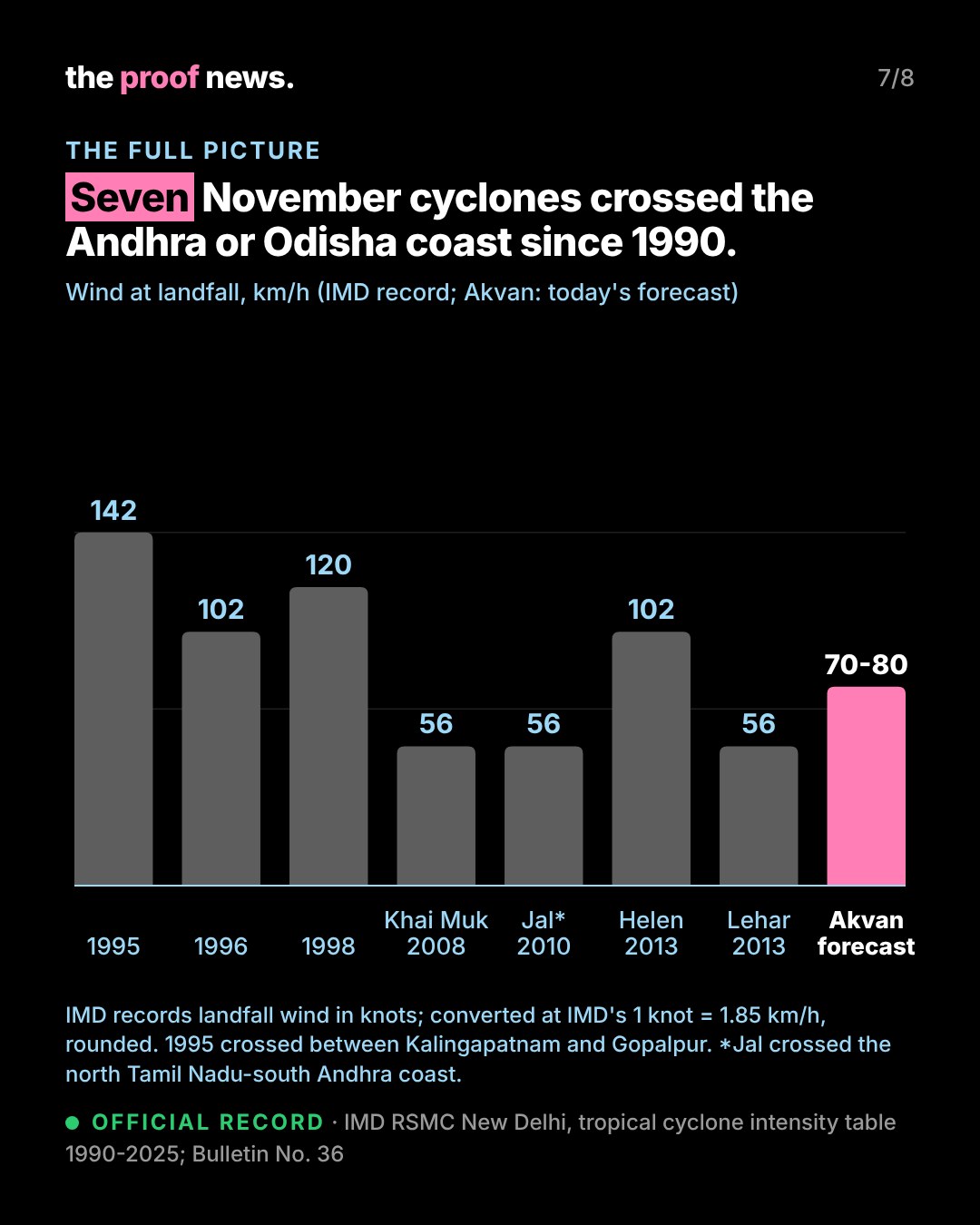
Official recordThe full picture: IMD's RSMC New Delhi table of North Indian Ocean cyclones lists seven November cyclones since 1990 that crossed the Andhra Pradesh or Odisha coast: 1995 (between Kalingapatnam and Gopalpur, 77 knots at landfall), 1996 (south of Kakinada, 55 knots), 1998 (near Visakhapatnam, 65 knots), Khai Muk 2008 (north of Kavali, 30 knots), Jal 2010 (north Tamil Nadu and south Andhra coast north of Chennai, 30 knots), Helen 2013 (south of Machilipatnam, 55 knots) and Lehar 2013 (south of Machilipatnam, 30 knots). At IMD's conversion of 1 knot = 1.85 km/h, that is 142, 102, 120, 56, 56, 102 and 56 km/h. Akvan's forecast landfall wind is 70-80 km/h. Past values are IMD's observed best-track figures; Akvan's is a forecast.
CommentaryThese are forecasts. IMD issues a bulletin every three hours; the next was due at 9 am IST on 20 November. No casualty figure has been officially reported for Akvan. We will update this page with IMD's landfall bulletin and official statements.
The proof.
Every forecast line, distance and warning copied from IMD Bulletin No. 36 and Advisory No. 28, and compared line by line with Bulletin No. 28; Odisha figures from the CMO's and I&PR's own posts (Odia text translated); 43 cancelled trains counted from East Coast Railway's six lists; the November record recounted from IMD's table and the knot conversions recomputed.
- IMD National Bulletin No. 36, 20.11.2026, 0530 IST (PDF)
- RSMC New Delhi Tropical Cyclone Advisory No. 28 (PDF)
- IMD National Bulletin No. 28, 19.11.2026 (PDF)
- IMD cyclone page
- IMD on X: landfall update, 20 Nov 6:50 am
- IMD on X: bulletin, 20 Nov 5:26 am
- CMO Odisha on X, 18 Nov (evacuation)
- CMO Odisha on X, 19 Nov (Rs 20.50 crore)
- I&PR Odisha on X: Khordha evacuation
- I&PR Odisha on X: Konark closure
- SRC Odisha on X: CM's review, 19 Nov
- SRC Odisha on X: Order No. 6976 (schools)
- SRC Odisha on X: intra-circle roaming
- APSDMA on X, 20 Nov 5:04 am
- East Coast Railway on X: cancellations (1)
- East Coast Railway on X: cancellations (2)
- East Coast Railway on X: cancellations (3)
- East Coast Railway on X: diversion of 20807
- IMD RSMC New Delhi: cyclone intensity table (XLS)