Cyclone Akvan: IMD now forecasts landfall between Narsapur and Puri by noon on 20 November, as a severe cyclonic storm
IMD moved its landfall forecast north at 1 pm on 18 November, from between Nellore and Visakhapatnam, and lowered the expected strength from a very severe to a severe cyclonic storm, 90-100 km/h gusting to 110. At 2:30 pm it issued a Red Message for the north Andhra Pradesh and south Odisha coasts; Odisha has ordered evacuations and closed schools in six districts.
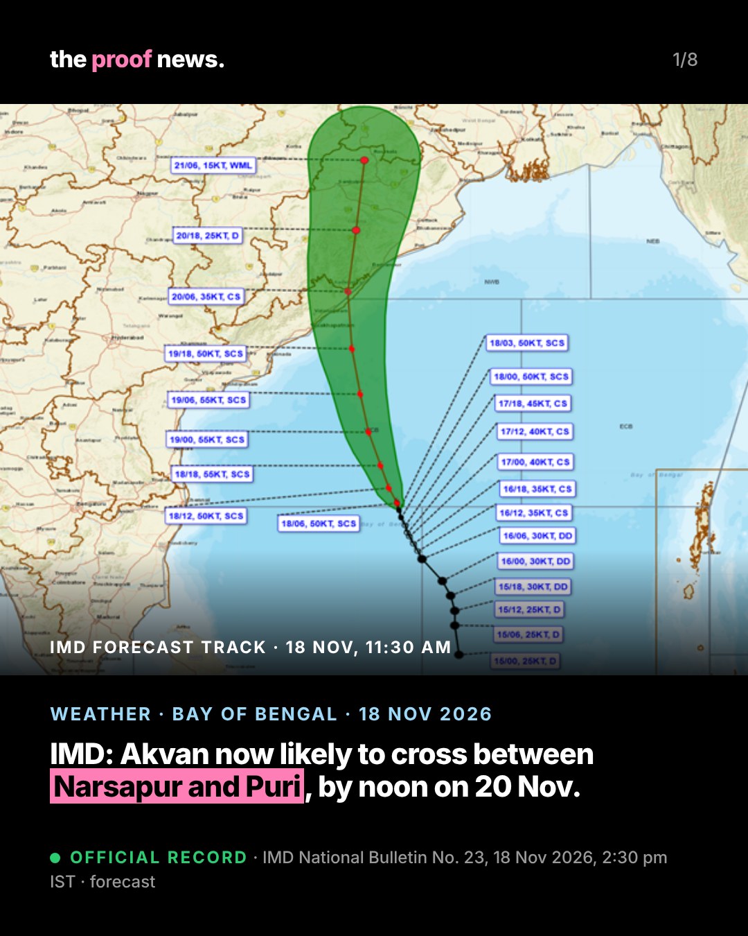
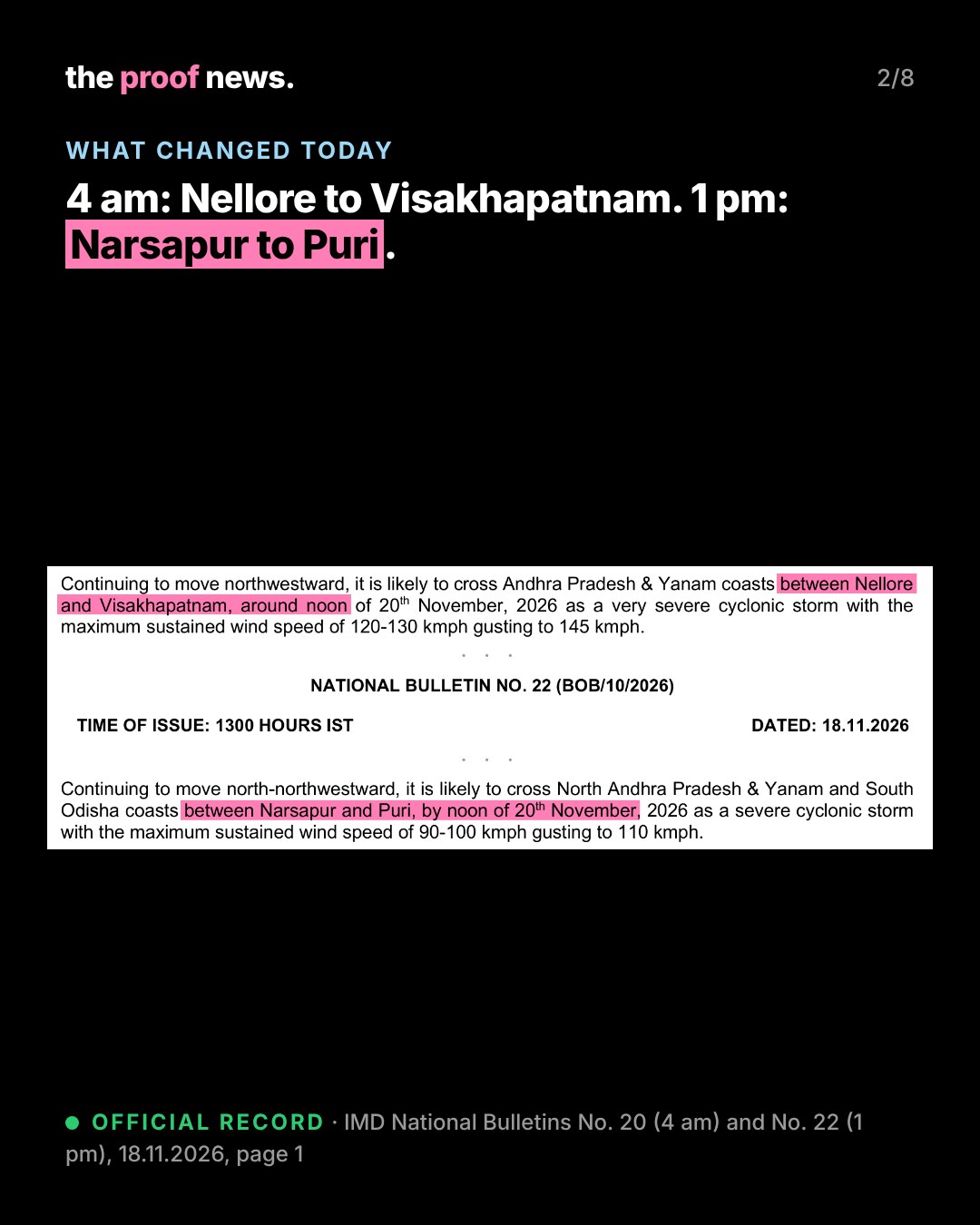
Official recordIMD's National Bulletin No. 22 (BOB/10/2026), issued at 1 pm IST on 18 November 2026, says Severe Cyclonic Storm Akvan lay at 8:30 am near 12.9°N, 85.4°E, about 580 km south-southeast of Visakhapatnam and 770 km south of Puri, and that "Continuing to move north-northwestward, it is likely to cross North Andhra Pradesh & Yanam and South Odisha coasts between Narsapur and Puri, by noon of 20th November, 2026 as a severe cyclonic storm with the maximum sustained wind speed of 90-100 kmph gusting to 110 kmph."
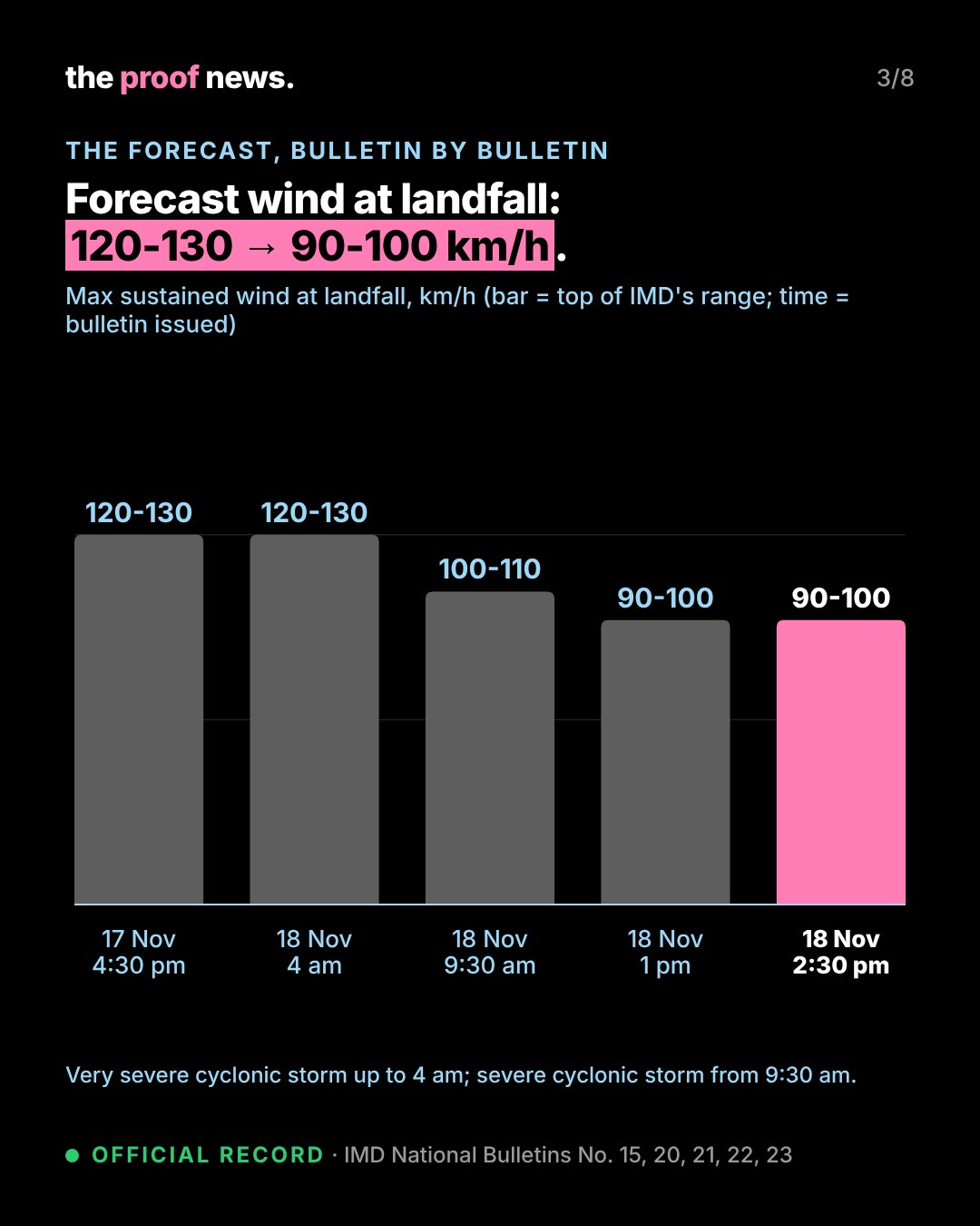
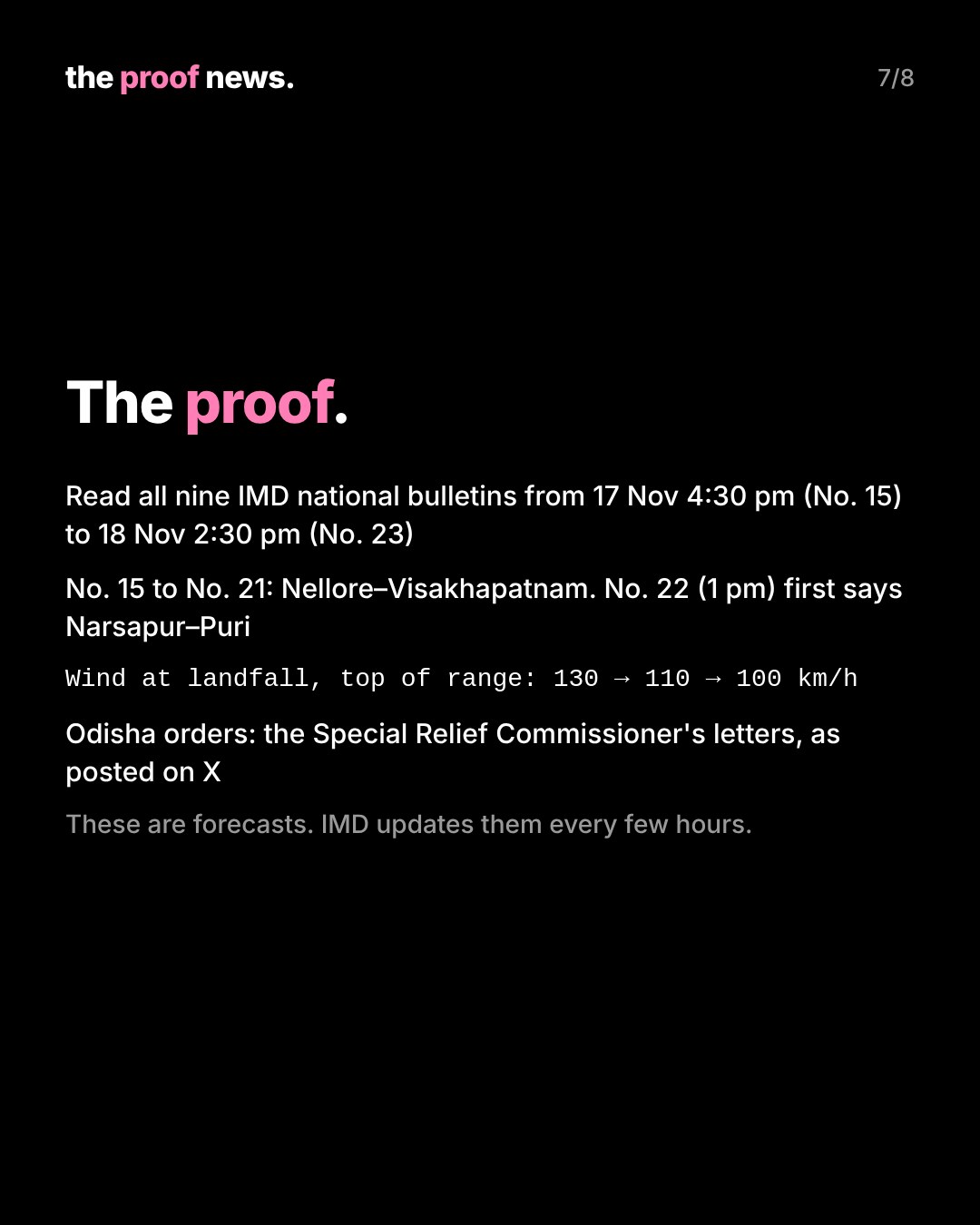
Official recordHow the forecast changed: IMD's bulletins No. 15 (17 November, 4:30 pm) to No. 20 (18 November, 4 am) all said Akvan would cross the Andhra Pradesh and Yanam coasts between Nellore and Visakhapatnam around noon on 20 November as a very severe cyclonic storm, 120-130 km/h gusting to 145 km/h. Bulletin No. 21 (9:30 am) kept the place and time but lowered the strength to a severe cyclonic storm, 100-110 km/h gusting to 120. Bulletin No. 22 (1 pm) moved the landfall to between Narsapur and Puri and lowered the wind to 90-100 km/h gusting to 110.
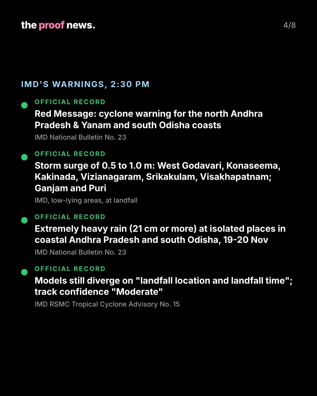
Official recordBulletin No. 23, issued at 2:30 pm, keeps that forecast and upgrades the alert to a "Cyclone Warning for North Andhra Pradesh & Yanam and South Odisha coasts—Red Message". At 11:30 am the storm lay near 13.1°N, 85.4°E, about 540 km southeast of Narsapur and 750 km south of Puri, moving north-northwest at 8 km/h.
Official recordIMD's warnings in Bulletin No. 23: a storm surge of 0.5 to 1.0 m above the astronomical tide is very likely to inundate low-lying areas of West Godavari, Konaseema, Kakinada, Vizianagaram, Srikakulam and Visakhapatnam districts in Andhra Pradesh and Ganjam and Puri districts in south coastal Odisha at landfall (the morning bulletins had listed Prakasam, Bapatla, Krishna, West Godavari, Konaseema, Kakinada and Visakhapatnam, with 0.4 to 1.2 m). Extremely heavy rainfall (21 cm or more) is likely at isolated places in coastal Andhra Pradesh and south Odisha on 19 and 20 November, with heavy to very heavy rain over north Odisha. Fishermen are advised not to venture into the westcentral Bay of Bengal till the morning of 21 November. IMD expects "Major Damage to thatched houses/huts/ kutcha houses" in north coastal Andhra Pradesh, Yanam and south Odisha, and suggests that coastal hutment dwellers be moved to safer places.
Official recordIMD's own caveat: its Tropical Cyclone Advisory No. 15 (based on 0600 UTC, 18 November) rates confidence in the forecast track and intensity as "Moderate" and says "considerable divergence exists regarding the subsequent movement, further intensification, landfall location and landfall time" among models; some models, it says, show the storm weakening below cyclone strength before landfall.
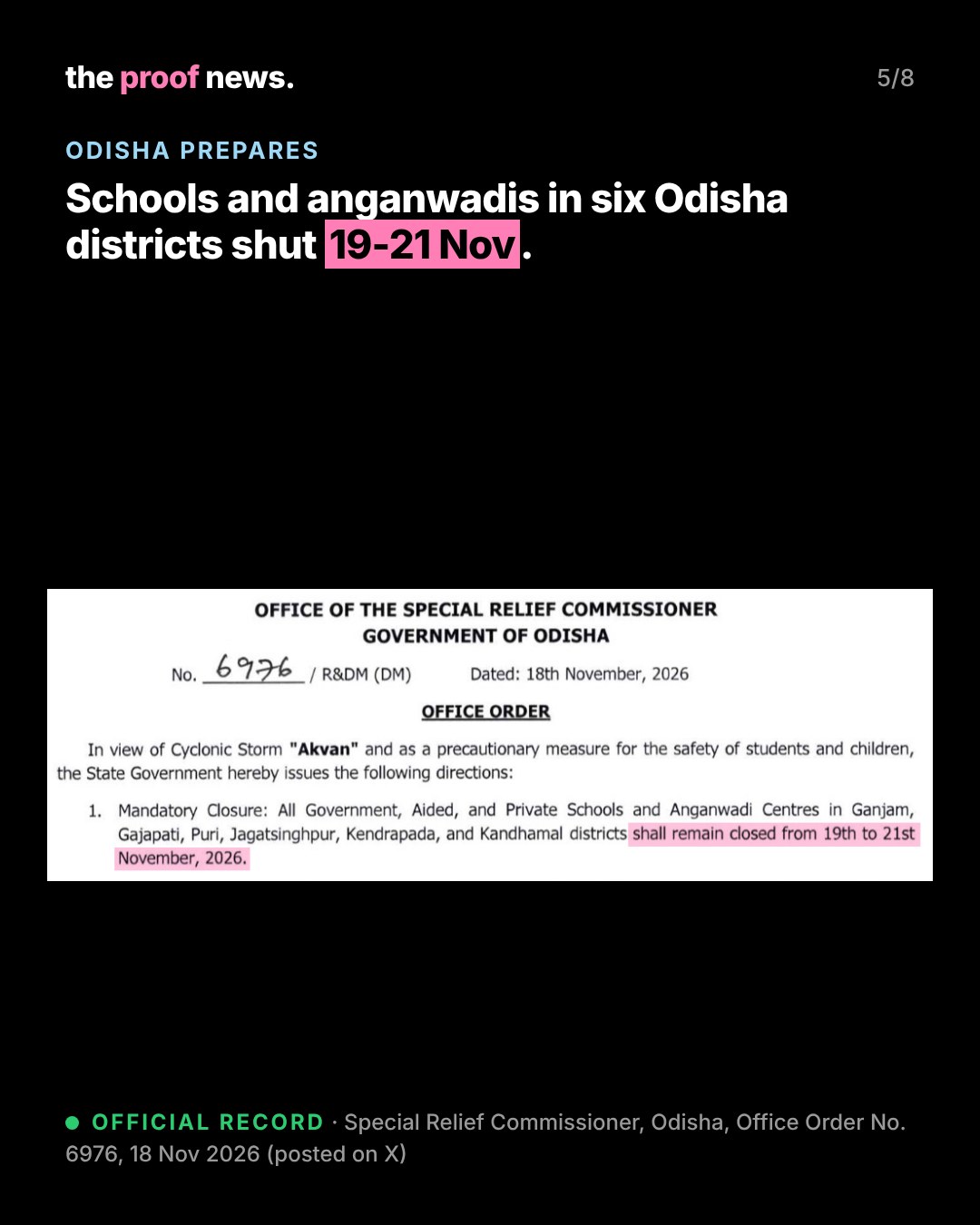
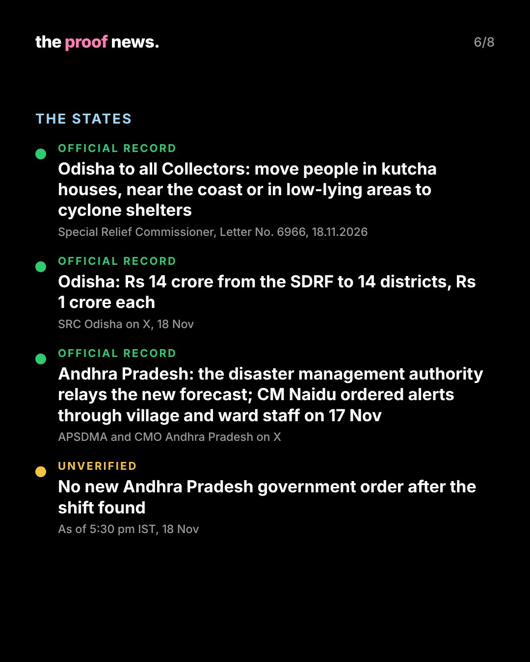
Official recordOdisha: the Special Relief Commissioner wrote to all Collectors on 18 November (Letter No. 6966) that people living in kutcha houses, near the coast or in low-lying areas of the affected coastal and adjoining districts "must be evacuated" to cyclone and flood shelters, and listed 14 districts likely to be affected. An office order of the same day (No. 6976) closes all government, aided and private schools and anganwadi centres in Ganjam, Gajapati, Puri, Jagatsinghpur, Kendrapada and Kandhamal from 19 to 21 November. The SRC also posted that Rs 14 crore has been released from the SDRF to 14 districts, Rs 1 crore each.
Official recordAndhra Pradesh: the state disaster management authority (APSDMA) relayed the new forecast on X. On 17 November Chief Minister N. Chandrababu Naidu's office said he had ordered weather alerts to reach people directly through village and ward staff and fishermen to be kept from going to sea. We found no new Andhra Pradesh government order issued after the forecast shift by 5:30 pm IST on 18 November.
CommentaryThese are forecasts, and IMD revises them every few hours. Our 17 November story on Akvan has been updated with this change.
The proof.
Every forecast line is quoted from IMD's national bulletins, which we read in full from No. 15 (17 November, 4:30 pm) to No. 23 (18 November, 2:30 pm) to find exactly when the landfall place and strength changed: No. 21 lowered the strength, No. 22 moved the place. The forecast track maps are IMD's own. Odisha's measures are from the Special Relief Commissioner's signed letter and order as posted on its official X account. Numbers are recomputed in proofs/e18-cyclone-akvan-shift/check.py.
- IMD National Bulletin No. 22, 18.11.2026, 1300 IST (PDF)
- IMD National Bulletin No. 23, 18.11.2026, 1430 IST (PDF)
- IMD National Bulletin No. 21, 18.11.2026, 0930 IST (PDF)
- IMD National Bulletin No. 20, 18.11.2026, 0400 IST (PDF)
- IMD RSMC Tropical Cyclone Advisory No. 15, 18.11.2026 (PDF)
- SRC Odisha on X: Letter No. 6966 to all Collectors, 18.11.2026
- SRC Odisha on X: Office Order No. 6976 (schools), 18.11.2026
- SRC Odisha on X: SDRF release to 14 districts, 18.11.2026
- APSDMA on X, 18.11.2026
- CMO Andhra Pradesh on X, 17.11.2026
- Our 17 Nov story on Akvan (updated)